The Micro User
 1st December 1985
Categories: Review: Software
Author: Andy Mack
Publisher: BBCSoft/BBC Publications
Machine: BBC Model B
Published in The Micro User 3.10
Package with exciting potential
It is always a pleasure to work through and write about quality productions.
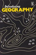
Here there are four programs from the BBC - Summit, Nomad, Flight and River - designed for the 10 to 12 year old range and linked to the BBC Schools Radio series Introducing Geography.
However, each of the set may be used quite independently and usefully integrated into a separate curriculum niche.
The standard ofprogramming is excellent and some of the graphics outstanding.
The representation of Mt. Everest in Summit and the world map in Flight are well worth seeing and set a standard that some educational software producers would do well to follow.
These programs are on three 5.25" discs with a 40-track format.
Included with the discs is a converter program for 80-track drives.
The package comes complete with a manual containing a description of each program, user instructions, help with recording information and notes for parents and teachers.
Summit is very useful as a logistics exercise and has much to offer. It is based on an attempt to climb Mt. Everest and simulates the organisational and environmental hazards faced by climbers with a "30-day" time limit.
They must conquer the peak between the end of the monsoon rains and the winter snows. The leaders have to organise the climbing route and, using teams of sherpas move the basic supplies of tents, food, rope and oxygen from the base camp to the higher camps.
In contrast to this, River aims to encourage an appreciation of river landscapes and is based on contour interpretation.
The route followed by a river must be traced out on a map using four basic directions.
There are three levels of difficulty which include questions that must be answered using basic river terminology.
An excellent part of this program is the explanation of cross-sections.
Nomad attempts to simulate the nomadic life of the Fulani in the sub-Saharan zone of West Africa.
It includes seasonal climatic changes, their effects on vege tation, and the inter-relationships of climate, vegetation, animal and human life.
My basic criticism of this program is the time it takes to complete, especially given the pressures on computer use in schools.
However it does have a number of potential uses and should be given careful consideration.
The fourth program, Flight, simulates four air journeys from London to Adelaide, Johannesburg, Buenos Aires and Los Angeles respectively.
It encourages the use of atlases and is the type of program that encourages much discussion and decision-making.
Questions related to the journey are asked during the flight and so very detailed route preparation is essential. Each group using the program has a separate call sign and this allows for more efficient classroom use.
A broad review of this type can only include an outline of each program. I suggest you view them if you can and assess whether you think each fits the way you see the subject being taught.
Certainly, my verdict is that each of these would be good value on its own. The whole package, therefore, represents an excellent buy with exciting potential.
Other Reviews Of Introducing Geography For The BBC Model B
Introducing Geography (BBC Soft)
A review by Des Thomas (A&B Computing)


